Quick answer
The Remutaka Rail Trail starts at Kaitoke in Upper Hutt (coordinates: Kaitoke, Upper Hutt 5018) and ends at Cross Creek near Featherston (Cross Creek, Featherston 5771). The trail runs for 18 kilometres through the Remutaka Forest Park, following the historic Fell locomotive route. Most riders begin at the Kaitoke end for a net downhill journey toward the Wairarapa Valley.
The Remutaka Rail Trail occupies the route of New Zealand's only Fell locomotive line, abandoned in 1955 when the Rimutaka Tunnel replaced the steep mountain crossing. That engineering history left behind a precisely graded corridor through native forest, now maintained by the Department of Conservation as a multi-use track open year-round. Where does the rail trail start and end becomes a practical question of elevation and shuttle logistics. The Kaitoke trailhead sits at approximately 220 metres above sea level on the western approach to the Remutaka Range. Riders departing from this point face a steady climb through regenerating bush, passing the Summit tunnel at 555 metres before descending toward the Wairarapa plains. The Cross Creek endpoint lies at roughly 160 metres elevation near Featherston, meaning those who begin at Kaitoke experience a net elevation loss after the initial climb to the summit. Conversely, starting from Cross Creek presents a longer, more gradual ascent followed by a shorter descent back to the Hutt Valley. Both trail termini offer car parking, though the Kaitoke end has larger capacity and direct highway access via State Highway 2. The Cross Creek access point requires navigating rural roads from Featherston township, with signage directing traffic to the DOC car park. Neither trailhead has facilities beyond basic track signage and information boards detailing the Fell engine history and track gradient profile. Transport coordination shapes most riders' decisions about rail trail endpoints and direction of travel. Shuttle services operating between Upper Hutt and Featherston allow one-way journeys, eliminating the need to retrace the 18-kilometre route. Self-sufficient groups often leave a second vehicle at the opposite trailhead or arrange pickups via local operators familiar with the trail access points. The western Kaitoke start remains more popular due to its psychological advantage—riders complete the hardest climbing in the first third of the journey, then enjoy a predominantly downhill return to the valley floor. The rail corridor's engineering legacy shows in its consistent gradient and wide formation. The original Fell rack-and-pinion system climbed grades as steep as 1-in-15, requiring the central rail and horizontal gripping wheels that gave the technology its name. Modern trail users benefit from the stable ballast and generous width that freight operations once demanded, though exposed sections near the summit can channel strong winds that sweep across the ridgeline from Cook Strait. Weather patterns differ sharply between the Remutaka trail start and end points. The Kaitoke western approach receives orographic rainfall as moist air rises against the range, while the Cross Creek side sits in the relative rain shadow of the Wairarapa. Riders beginning from Upper Hutt may encounter low cloud and drizzle even when Featherston enjoys clear conditions, a meteorological split that influences preparation decisions for those unsure which direction to ride.
“The original Fell rack-and-pinion system climbed grades as steep as 1-in-15, requiring the central rail and horizontal gripping wheels that gave the technology its name.”
Where Does The Rail Trail Start And End: Trailhead Access Points
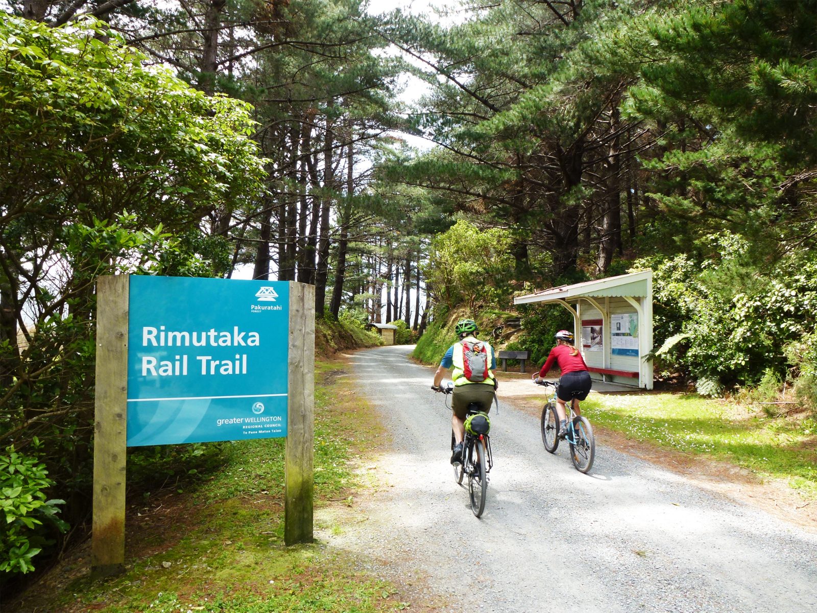
The Remutaka Rail Trail spans the Remutaka Range, with primary access points located at the Kaitoke car park in Upper Hutt and the Cross Creek car park in Featherston. Most visitors approach the trail by car to reach these trailheads, which serve as the two ends of the route.
State Highway 2 to Kaitoke regional park turnoff
State Highway 2 to Western Lake Road, then Cross Creek Road
Metlink Wairarapa Line to Upper Hutt Station
Opening Hours For Where Does The Rail Trail Start And End
The Remutaka Rail Trail is a public track that remains open 24 hours a day throughout the week. As it is a public facility, access is available at all times.
| Monday | 00:00–23:59 | |
|---|---|---|
| Tuesday | 00:00–23:59 | |
| Wednesday | 00:00–23:59 | |
| Thursday | 00:00–23:59 | |
| Friday | 00:00–23:59 | |
| Saturday | 00:00–23:59 | |
| Sunday | 00:00–23:59 |
Entry Fees For Where Does The Rail Trail Start And End
The Remutaka Rail Trail is a public track managed by the Department of Conservation. There are no entrance fees required to access or use the trail.
A typical adult pays 0 NZD, as there are no fees to access the trail at any point.
Best Time To Visit When Considering Where Does The Rail Trail Start And End
The best arrival window is 00:00–23:59; however, the trail is best enjoyed during daylight hours for safety. Planning your journey within these hours ensures optimal visibility of the historical rail features and terrain.
Summer (Dec–Feb)
HighWarm with 18–24°C; dry conditions.
Longer daylight provides more time for completion.
Autumn (Mar–May)
ModerateMild with 12–18°C; occasional wind.
Stable conditions suitable for consistent riding.
Winter (Jun–Aug)
LowCold with 5–12°C; frequent rain.
Requires high-quality gear for wet track surfaces.
Spring (Sep–Nov)
ModerateVariable with 10–16°C; often windy.
Wind exposure increases, so check weather reports.
Verdict: The best time to visit is during the shoulder months of March, April, October, or November, arriving early in the morning to maximize daylight.
Preparation Checklist For Where Does The Rail Trail Start And End
The Remutaka Rail Trail is a one-way journey between two townships, requiring vehicle logistics and weather-appropriate gear for the exposed high-country sections.
-
Arrange vehicle pickup at trail's end — The 18 km trail runs one-way from Kaitoke to Cross Creek, requiring transport coordination between start and finish points.
-
Pack water and snacks for the journey — The trail takes 3–5 hours with limited facilities along the route.
-
Bring layers for variable mountain weather — Elevation changes and exposed sections mean conditions shift quickly, especially around the Summit Tunnel.
-
Check trail conditions before departing — Winter ice, summer heat, and seasonal maintenance closures can affect accessibility.
-
Carry lights if riding near dusk — The 576-metre Summit Tunnel is unlit and requires front and rear lights for safe passage.
-
Wear sturdy footwear suitable for gravel — The compacted gravel surface is mostly smooth but can be loose in sections.
Check availability
Frequently asked questions about where does the rail trail start and end
Everything you need to know about where does the rail trail start and end